TUNISIA : GEOGRAPHIC
Introduction :
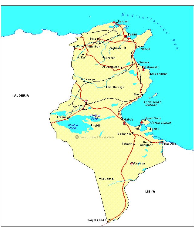
Equal in size to that of England and Wales, Tunisia is the
smallest of the four countries in North Africa that make up
the Maghreb.
It shares a border with Algeria in the west and Libya in the
south east. To the east and north the country's 16,000km of
coastline borders the Mediterranean Sea.
Topography :
The country has three distinct physical regions:
Northern Tunisia, Central Tunisia, and Southern Tunisia.
In the north the Atlas mountains form the Northern Tell and
High Tell ranges. They are separated by the wide fertile
Medjerda valley, a major agriculture region notable for
producing cereals. In places, the mountains with altitudes
exceeding 1,000m, are covered with cork oak and pine forests.
The highest summits are Mt. Chambi near the Algerian border
and Mt. Mrhila southwest of Tunis.
Central Tunisia is semi-arid steppe plateau. The Sahel,
a low lying flat westward extension of the coastal plain which
extends into Libya, has seasonal salt lakes and olive groves.
Southern Tunisia, which stretches from the Algerian border to
the Mediterranean, contains extensive seasonal salt flats and
spectacular date palm plantations.
The extreme south of Tunisia gives way to the Sahara desert.
Climate :
There are considerable differences between the climate in the
north and south of Tunisia. The north's climate is typically
Mediterranean, with hot dry summers and mild wet winters.
In the south, the proximity to the Sahara increases the aridity
of the landscape , and makes an unpleasant summer climatic
combination of high humidity and high temperatures.
Rainfall is irregular and droughts are common. Temperatures
along the coast average 7°C (45°F) in winter and 32°C (90°F) in summer.
In the South fierce hot, dry Sirocco winds from the Sahara take
temperatures into the mid-40s C. The winds have a serious effect of
both plant and human life.
Spring and Autumn are the best times to visit Tunisia, although the
summer is popular despite the severity of the heat.
|